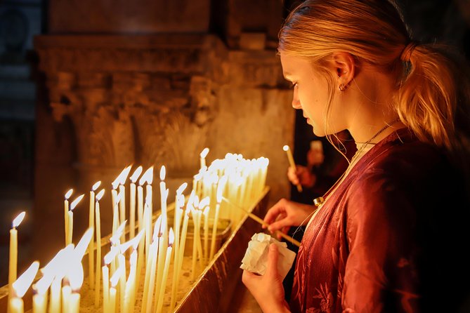
During the visit of Hadrian to Judea in the 130s AD, Jerusalem's ruins were surveyed and Hadrian decided to build a Roman colony in its place, naming it Colonia Aelia Capitolina, after the Roman deities Jupiter, Juno and Minerva (the Capitoline Triad), worshiped at the Capitoline Hill temple in Rome. Like many Roman colonies, Aelia Capitolina was laid out with a Hippodamian grid plan of narrower streets and wider avenues. Notably, the decision was one of the main causes of the Bar Kokhba revolt, which shortly encompassed the region. The main north-south thoroughfare, the Cardo Maximus, was originally a paved avenue approximately 22.5 meters wide (roughly the width of a six lane highway) which ran southward from the site of the Damascus gate, terminating at an unknown point. The southern addition to the Cardo, constructed under Justinian in the 6th century AD, extended the road further south to connect the Church of the Holy Sepulchre with the newly built Zion Gate. Along its length, the roadway was divided into three parts: two colonnaded covered walks flanking a 12 meter wide road. The shaded porticoes provided separation of pedestrian traffic from wheeled carts, shelter from the elements, space for small-scale commerce, as well as opportunities for residents and visitors to gather and interact. The central open pavement provided commercial access as well as ritual space. The Cardo's most striking visual feature was its colonnade, clearly depicted on the Madaba Map. Simple bases supported monolithic shafts, spaced 5.77 meters apart. The shafts supported Byzantine-style Corinthian capitals – intricately carved, but more stylized versions of their Classical counterparts. Although this combination of elements was uniform the preserved examples display some variation in the profile and size of the bases, and in the pattern of the capitals. Despite aesthetic differences, the approximate height of the base, column, and capital units of the colonnade was five meters, a height which contributed to the spaciousness of the porticoes. The wall of the Cardo's eastern portico featured an arcade that housed various stalls and workshops leased by craftsmen and merchants. The line of the Cardo Maximus is still visible on the Jewish Quarter Street, though the original pavement lies several meters below the modern street level. In the 7th century, when Jerusalem fell under Muslim rule, the Cardo became an Arab-style marketplace. Remains of the Byzantine Cardo were found in the Jewish Quarter excavations beginning in 1969. In 1971, a plan for preserving the ancient street was submitted by architects Peter Bogod, Esther Krendel and Shlomo Aronson. Their proposal relied heavily on the sixth century Madaba map, a mosaic map of Jerusalem found in 1897 in Madaba, Jordan. The map clearly showed the Roman Cardo as the main artery through the Old City. The architects proposed a covered shopping arcade that would preserve the style of an ancient Roman street using contemporary materials. Their plan was based on the hope that archeologists would find remains of the southern end of the Cardo, an extension of the north-south Roman thoroughfare built during the Byzantine era (324–638). Time was of the essence and mounting pressure to repopulate the Jewish Quarter led to the construction of a superstructure which allowed the residential buildings to be built while the archaeologists continued to work below. The project was 180 meters in total and was divided into eight sections to allow for construction teams to move quickly from one section to another. By 1980, 37 housing units and 35 shops were built, incorporating archaeological finds such as a Hasmonean wall from the second century BC and rows of Byzantine columns. The combination of old and new is also visible on the Street of the Jews, where the shops have been set into old vaults and the gallery is covered by an arched roof containing small apertures to allow for natural lighting.

Cardo Tours and Tickets
🎧 No audio guides are available in this language.
During the visit of Hadrian to Judea in the 130s AD, Jerusalem's ruins were surveyed and Hadrian decided to build a Roman colony in its place, naming it Colonia Aelia Capitolina, after the Roman deities Jupiter, Juno and Minerva (the Capitoline Triad), worshiped at the Capitoline Hill temple in Rome. Like many Roman colonies, Aelia Capitolina was laid out with a Hippodamian grid plan of narrower streets and wider avenues. Notably, the decision was one of the main causes of the Bar Kokhba revolt, which shortly encompassed the region. The main north-south thoroughfare, the Cardo Maximus, was originally a paved avenue approximately 22.5 meters wide (roughly the width of a six lane highway) which ran southward from the site of the Damascus gate, terminating at an unknown point. The southern addition to the Cardo, constructed under Justinian in the 6th century AD, extended the road further south to connect the Church of the Holy Sepulchre with the newly built Zion Gate. Along its length, the roadway was divided into three parts: two colonnaded covered walks flanking a 12 meter wide road. The shaded porticoes provided separation of pedestrian traffic from wheeled carts, shelter from the elements, space for small-scale commerce, as well as opportunities for residents and visitors to gather and interact. The central open pavement provided commercial access as well as ritual space. The Cardo's most striking visual feature was its colonnade, clearly depicted on the Madaba Map. Simple bases supported monolithic shafts, spaced 5.77 meters apart. The shafts supported Byzantine-style Corinthian capitals – intricately carved, but more stylized versions of their Classical counterparts. Although this combination of elements was uniform the preserved examples display some variation in the profile and size of the bases, and in the pattern of the capitals. Despite aesthetic differences, the approximate height of the base, column, and capital units of the colonnade was five meters, a height which contributed to the spaciousness of the porticoes. The wall of the Cardo's eastern portico featured an arcade that housed various stalls and workshops leased by craftsmen and merchants. The line of the Cardo Maximus is still visible on the Jewish Quarter Street, though the original pavement lies several meters below the modern street level. In the 7th century, when Jerusalem fell under Muslim rule, the Cardo became an Arab-style marketplace. Remains of the Byzantine Cardo were found in the Jewish Quarter excavations beginning in 1969. In 1971, a plan for preserving the ancient street was submitted by architects Peter Bogod, Esther Krendel and Shlomo Aronson. Their proposal relied heavily on the sixth century Madaba map, a mosaic map of Jerusalem found in 1897 in Madaba, Jordan. The map clearly showed the Roman Cardo as the main artery through the Old City. The architects proposed a covered shopping arcade that would preserve the style of an ancient Roman street using contemporary materials. Their plan was based on the hope that archeologists would find remains of the southern end of the Cardo, an extension of the north-south Roman thoroughfare built during the Byzantine era (324–638). Time was of the essence and mounting pressure to repopulate the Jewish Quarter led to the construction of a superstructure which allowed the residential buildings to be built while the archaeologists continued to work below. The project was 180 meters in total and was divided into eight sections to allow for construction teams to move quickly from one section to another. By 1980, 37 housing units and 35 shops were built, incorporating archaeological finds such as a Hasmonean wall from the second century BC and rows of Byzantine columns. The combination of old and new is also visible on the Street of the Jews, where the shops have been set into old vaults and the gallery is covered by an arched roof containing small apertures to allow for natural lighting.
Overview
More Info
- During Byzantine Jerusalem a sunken north-south thoroughfare was built across the city, from what is now the Damascus Gate southward toward the Zion Gate. The general term for such a main street in Ancient Roman cities was cardo maximus, and today, the street is simply called the Cardo.Today the Cardo begins just south of David St. and is only half its original width — it was once as wide as a six-lane highway — and passes into the modern-day Jewish Quarter. A walk along the Cardo will reveal a strip of high-end shops selling souvenirs, Judaica, jewelry and artwork. A southern portion of the Cardo has been restored with colonnaded walkways, much like it had during the sixth century.The area surrounding the Cardo contains several worthwhile archaeological excavations of the First and Second Temples.
More Adventures for You


0$
0$
3000$
Price From
$109.00 USD
Starting from Tel Aviv, cover three of the region's top sights in just a day. Drive to Jerusalem, and explore the Old City with our guided tour which includes the Western Wall, Via Dolorosa and Church of the Sepulchre. Enjoy a tour Bethlehem, the city of the birth of Jesus Christ including Church of the Nativity. Descend through the Judean Desert to the Dead Sea. Float in the waters and immerse in the famous muds. Ending the day, return to Tel Aviv._en-US
Learn More
Price From
10.00 USD
Witness first-hand the ancient and religious sites of Jerusalem on this thought-provoking full-day coach and walking tour. With an expert guide beside you to give everything powerful meaning and context, see the holy Christian and Jewish sites of Old Jerusalem, including the Western Wall, Via Dolorosa (no. 10-14) and Church of the Holy Sepulchre, said to stand where Jesus was crucified. A view of Mount of Olives , and time at the moving Holocaust Museum in New Jerusalem, provide the final, compelling touches to your day._en-US
Learn More
Price From
5.00 USD
Step off your cruise ship in Ashdod port and make the most of a day in the Holy Land with a tour of Jerusalem and Bethlehem. The itinerary for this tour was created specifically for cruise passengers docking at Ashdod port. Tour guide will meet you when you disembark, and take you to Jerusalem in a comfortable vehicle with A/C. Stop to get an overview of the city from Mount Scopus before continuing to Jerusalem’s Old City. Pass the Mount of Olives, and spot the Church of All Nations and the adjacent Garden of Gethsemane. Drive parallel to the Old City walls alongside Kidron Valley, and the Ophel Promenade. Enter the Old City for a walking tour of top sites like the Western Wall, the Cardo, and Via Dolorosa. Tour the Sepulcher Church, and explore the Old City market before taking a lunch break. The tour leaves Jerusalem passing Mount Zion. The next stop is Bethlehem, to see the Nativity Church. At the end of the tour, you’ll be returned to Ashdod port and your cruise ship. _en-US
Learn More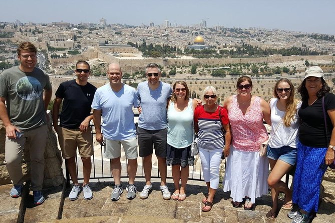
Price From
$225.00 USD
Visit religious highlights of Jerusalem and Bethlehem, on a full-day, group tour to Jerusalem and Bethlehem from Ashdod Port. Take in views from the Mount of Olives, and pass the Garden of Gethsemane as you enter old Jerusalem. Follow Jesus footsteps in Jerusalem walk along Via Dolorosa and Stations of the Cross, Church of Church of Holy Sepulchre, say a prayer beside the Western Wall in Jewish Quarter. Visit Bethlehem, The Church of the Nativity where Jesus was born._en-US
Learn More
Price From
$220.00 USD
Private full day tour to combine Jerusalem & Dead Sea. Tour to holy city of Jerusalem and iconic Dead Sea. Panoramic view from the Mount of Olives to Jerusalem old city. Walk through Jewish & Christian Quarters, Western Wall, Cardo. Continue along the Via Dolorosa to the Church of the Holy Sepulcher. Then proceed to the Dead Sea to float weightless and having a refreshing mud-bath. _en-US
Learn More